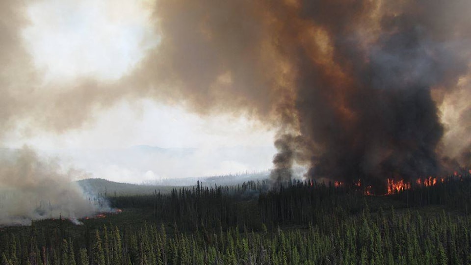
The Shovel Lake wildfire, burning about 30 km northeast of Burns Lake, has grown to approximately 5000 hectares since it was discovered last Friday.
The fire remains zero per cent contained.
The B.C. Wildfire Service said elevated fire behaviour was anticipated yesterday given the increased temperatures and lower relative humidity.
As of Aug. 1, 101 firefighters, seven helicopters and 33 heavy equipment have been deployed to the site. An incident management team has been deployed to manage this fire.
Crews are continuing to work to establish containment on the southern flank with machine guard and hose lay. Yesterday crews successfully supported containment lines by performing a burn out two km up the Owl Lake Extension road.
Accordign to the B.C. Wildfire Centre, burning out reduces the fire spread potential by eliminating unburned forest fuels between a control line and the fire perimeter. Burning out can bring the fires edge to natural boundaries like a lake or rock outcropping or to constructed boundaries like machine or hand guard.
Firefighters are also working on the western and northern flanks of the fire today by reopening the road system between Nest Road and Roof Road to support the establishment of containment lines and completing the equipment guard along Helene Lake.
BC Wildfire Service is working with local industry for additional equipment support. Active fire behavior is expected for today given moderate winds, high temperatures, and low relative humidifies, as well more thunderstorm activity is expected for this afternoon.
The cause of the fire is still under investigation.
The RDBN issued an evacuation alert on July 29, 2018. The alert is in effect for the area east of the Augier Main Forest Service Road to the Trout and Sutherland Forest Service Roads, and south of Sutherland River Park to Hwy. 16. This includes parts of the RDBN’s Electoral Area B, C and D. This alert does not include Endako.
READ MORE: Evacuation alert issued due to Shovel Lake Wildfire
The RDBN is urging those in the evacuation area to be prepared for an evacuation order by gathering essential items and having them be readily available for quick departure, locating family members or co-workers and planning to meet outside the evacuation, should an evacuation order be called.
The B.C. Wildfire Service issued an area restriction order July 30 for Crown land in the vicinity of the Shovel Lake wildfire.
READ MORE: Area restriction order in effect northeast of Burns Lake
According to Carolyn Bartos, fire information officer for the Northwest Fire Centre, this area restriction was put in place to protect public safety due to the wildfire’s rate of spread and to avoid interference with fire suppression efforts.
The area restriction will remain in place until noon on Sept. 15, 2018, or until the order is rescinded.
Air quality advisories are in effect for most of the province as a result of smoke from wildfires. Most of this smoke can be attributed to local fires, but some, especially in the north, has drifted in from other provinces as well as internationally.
READ MORE: Smoke from wildfires visible in Houston
To report a wildfire, unattended campfire or open burning violation, call 1-800-663-5555 toll-free, or *5555 on a cellphone.
@flavio_nienow
flavionienow@gmail.com
Like us on Facebook and follow us on Twitter.