Geoscience BC hopes their latest data recently released will spark investment in mineral exploration in northern B.C.
The latest aerial survey, called search phase III, was conducted last summer to identify hidden mineral potential in a 9600-square-km area located approximately 200 km north of Houston - from the Kemess Underground mine south to near Mackenzie.
Although search phase III did not include the District of Houston, the district was one of the closest communities to the project and would likely benefit from any economic activity in the project area.
“Search Phase III highlights new potential deposits containing metals like copper in a region that has been home to several mines in the past,” explained Bruce Madu, Geoscience BC Vice President of Minerals and Mining. “It’s an exciting example of how new science can be used to drive investment and stimulate our economy.”
Watch a Geoscience BC video of the search phase III:
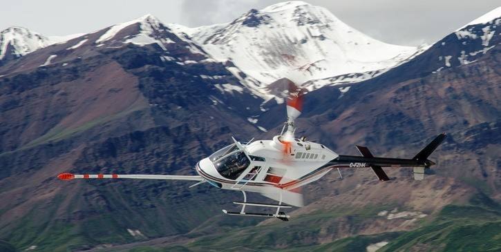
Helicopters equipped with ultra-sensitive magnetometers flew at a constant elevation of 80 metres for more than 40,000 km in the area - the equivalent of flying around the Earth.
According to Geoscience BC, search phase III data highlights where mineral deposits may be with more accuracy than ever before. This will help the exploration sector, communities, First Nations and governments to plan future land use and attract investment.
“Globally, the increased demand for technologies like smartphones and electric cars is also increasing the demand for metals and minerals produced in British Columbia,” said Michelle Mungall, Minister of Energy, Mines and Petroleum Resources. “Geoscience BC projects like this are critical to sparking exploration, discovery and ultimately the production of metals such as copper, which are used for these items every day.”
Now that results are published, Geoscience BC plans to continue working with First Nations and other communities in the project area to demonstrate how they can best use the new data.
All aerial survey results - from raw data to a series of summary maps - are available publicly on the Geoscience BC’s website at http://www.geosciencebc.com/s/SearchProject.asp.
The $1.7 million project was funded by Geoscience BC and Northern Development Initiative Trust (NDIT).
“We continue to value our partnership with Geoscience BC and commend them for their work on search phase III,” said NDIT CEO Joel Mackay. “This data is critically important to informing mineral exploration decisions, and helping our region capitalize on global trends.”
Search phase III was a continuation of search phase II, which was conducted in the summer of 2016 in Burns Lake, Smithers, Houston, Vanderhoof and Fraser Lake. Search phase II found indications of copper, silver and molybdenum deposits in the region.
Burns Lake’s Baker Airport was the initial base for search phase II. The base was later moved to Smithers due to a runway repaving project at the Burns Lake airport.
Geoscience BC is an independent, non-profit organization that generates earth science information in collaboration with First Nations, local communities, governments, academia and the resource sector. Core funding for Geoscience BC is provided by the provincial government.