The Nadina Lake Wildfire, located 60 km south of Houston, has grown to approximately 5,640 hectares after showing aggressive fire behaviour yesterday.
Although burn-out operations were conducted Sunday along Nadina Lake to prevent future fire spotting towards private property, equipment and crews were pulled off the fire yesterday due to this significant activity.
According to the B.C. Wildfire Service, this fire is 20 per cent contained.
An evacuation order is in effect for the east end of Nadina Lake, including Nadina Lake Lodge, Nadina River Spawning Channel and Nadina Lake Recreation Site.
And evacuation alert is also in effect east of Glacier Forest Service Road (FSR) to the Morice-Own FSR and Ootsa Nadina Road, south of Tagetochlain Lake and the Nadina FSR/Morice-Owen FSR intersection to Andrews Bay FSR, Shelfords FSR and Horseshoe Hookup FSR.
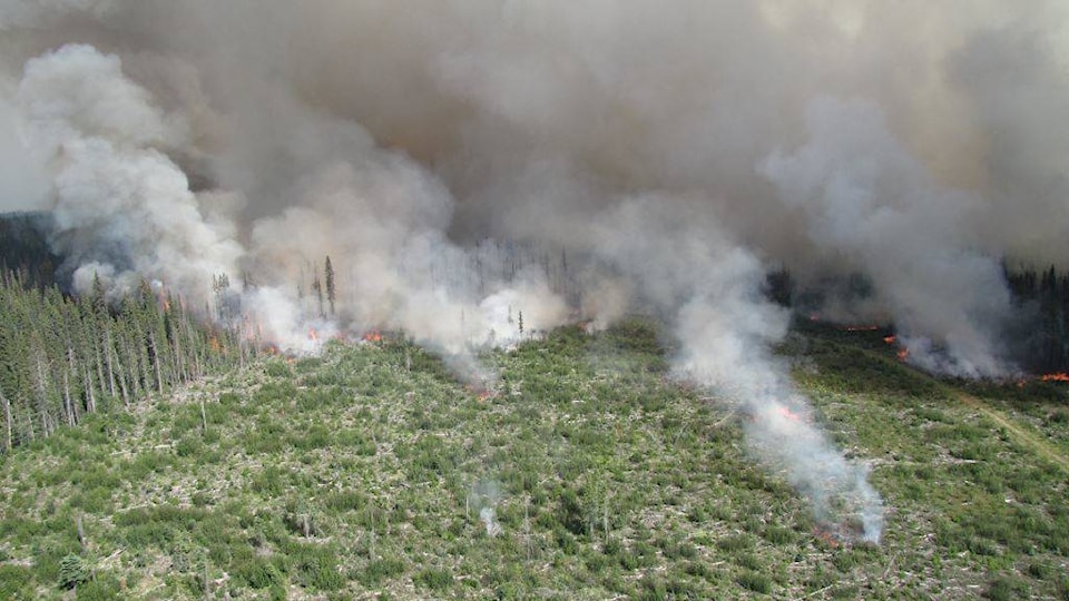
Shovel Lake Fire shows aggressive behaviour
The Shovel Lake Fire, burning about 30 km northeast of Burns Lake, also saw aggressive fire behaviour yesterday. It has now consumed 5,400 hectares and is 20 per cent contained.
READ MORE: Shovel Lake wildfire still growing
An evacuation alert continues to be in effect east of the Augier Main FSR to the Trout and Sutherland Forest Service Roads, South of Sutherland River Park to Hwy. 16. This alert does not include Endako.
Expanded evacuation order for Island Lake Wildfire
The Island Lake Wildfire, located south of Francois Lake, is now estimated at 2230 hectares and is 10 per cent contained.
The Regional District of Bulkley-Nechako (RDBN) has issued an expanded evacuation order for the area. The order is in effect for the area including 43485 and 44250 Holy Cross Binta FSR to the east of Borel Lake, including Anzus Lake Recreation Site, Borel Lake Recreation Site and Burner Recreation Site.
An expanded evacuation alert has also been issued for the area including Binto Wo FSR to 400 metres east of Nithi Road, Nithi Pit Road and a portion of Holy Cross Binta FSR, as well as South of Francois Lake to above the Binta Main FSR.
Verdum Mountain Wildfire 100 per cent contained
The Verdum Mountain Wildfire, located 17 km southwest of Grassy Plains, has consumed 52 hectares but is now 100 per cent contained.
An evacuation alert for the area was maintained yesterday. The alert is in effect for the area east of Keefes Landing Road to Eakin Settlement Road and south to Spud Lake Road.
New evacuation order for Torkelsen Wildfire
The Torkelsen Wildfire, discovered last Saturday, has grown to approximately 80 hectares. This fire is located approximately 24 km south of Fort Babine and is zero per cent contained.
An evacuation order is in effect for the areaeast of the Nilkitkwa FSR along the shore of Babine Lake, north of Smithers Landing and South of Fort Babine reserve lands TSAK 9. This order does not include Smithers Landing or Fort Babine reserve lands TSAK 9.
Evacuation order in effect for Purvis Lake wildfire
The Purvis Lake wildfire, located 20 km east of Takla Lake, is estimated at 1,600.0 hectares.
An evacuation order is in effect for the area including Purvis Lake to Tchentlo Lake and the Tchentlo FSR, south of Nation Lakes Park to the intersection of the Leo Creek FSR and the Driftwood FSR. This order does not include the Driftwood FSR.
Evacuation alert for W Babine River Wildfire
The RDBN is also maintaining an evacuation alert for the area near the W Babine River Wildfire, including the Silver Hilton Lodge and the Babine River, including portions of the Thomlinson Creek and Shelagyote River.
To check out the full list of evacuation orders and alerts for the area, visit https://www.rdbn.bc.ca.
@flavio_nienow
flavionienow@gmail.com
Like us on Facebook and follow us on Twitter.